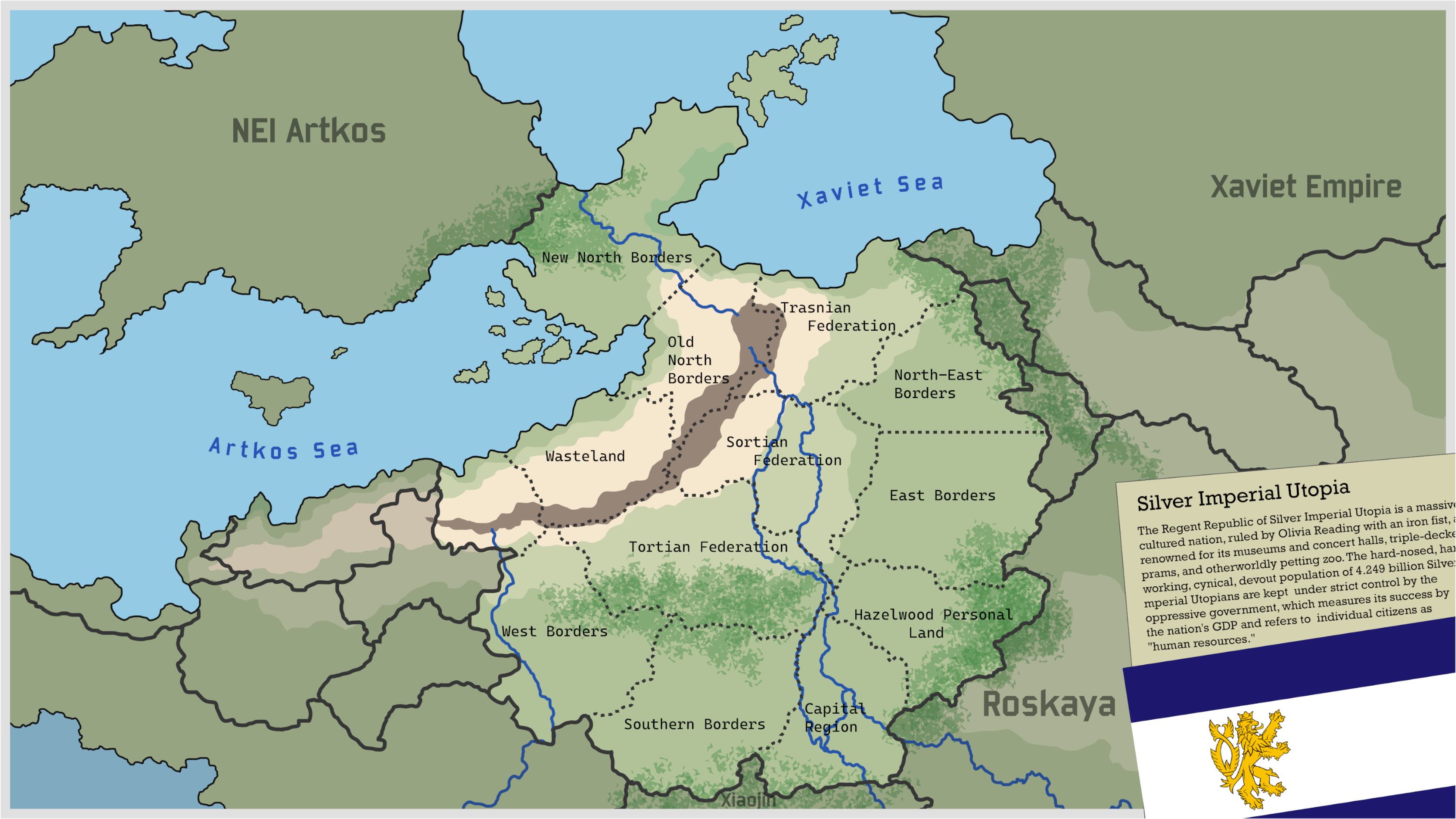
File:Utopia Topography.png
From Commonwealth of Sovereign States
Size of this preview: 800 × 450 pixels. Other resolution: 3,340 × 1,880 pixels.
Original file (3,340 × 1,880 pixels, file size: 1.97 MB, MIME type: image/png)
Summary
Topographic map of the Utopian sub-continent.
File history
Click on a date/time to view the file as it appeared at that time.
| Date/Time | Thumbnail | Dimensions | User | Comment | |
|---|---|---|---|---|---|
| current | 13:53, 4 October 2025 | | 3,340 × 1,880 (1.97 MB) | Silver Imperial Utopia (talk | contribs) | Topographic map of the Utopian sub-continent. |
You cannot overwrite this file.
File usage
The following page uses this file: